
The Wetland at Eloise Butler Wildflower Garden
The Geography and the Pool

The small boggy wetland in the center of the Woodland Garden, while less than 2 acres, gives visitors a glimpse of a unique community. Many similar bogs and wetlands occurred throughout the Bryn Mawr and nearby Golden Valley neighborhoods, but only two survived development. Almost all were either drained and filled for housing or dredged to create the myriad of pastoral ponds so prevalent in Golden Valley. Because it is the sole survivor (along with the Quaking Bog across Wirth Parkway), and a habitat virtually impossible to recreate, special care is given to assure its survival.
Eloise Butler wrote in 1915: "The site of the Wild Garden was chosen particularly on account of the tamarack swamp and adjacent meadows which contained several interesting or beautiful plants that were not to be found elsewhere in the vicinity of Minneapolis." (1)(Article)
On the plan map shown here (click on image for enlargement) one can see the wetland area at or below the 840 foot contour level, significantly below the 906 foot contour level at the south end of the Woodland Garden, and even further below the 921 foot high point in the Upland Garden. In Eloise Butler's time the path through the center did not exist and there was a tamarack bog at the south end of the wetland which drained north. Eloise explains further:
A tiny stream threaded the bog and emerged into a depressed area of slimy ooze flanked by low banks. A dam was constructed that converted the depression into a lovely pool that has become a favorite sketching point for artists.(2) (Her 1926 history and in the article cited above)
The dam Eloise placed was an earthen dam which she naturalized with plantings and the newly created pool was used for aquatic plants. The water flowing over the dam trickled downward over (or under - uncertain?) a tarvia path and then entered the north meadow (an area now outside the Garden's back fence). An early description of this pool and dam reads:
“The pool is formed by a grass and moss covered earthen dam, which has been thrown across a brook's course. The dam is almost, though not quite, such as beavers would have made, but it is now so covered with things growing at random, as they do in wild places, that it seems the work of nature itself. It is however, the only bit of artificial work in the entire garden.”(3)
Below: The pool formed by Eloise Butler's Dam as illustrated in the the May 1913 issue of The Bellman.

The dam was in place prior to the Fall of 1909 as after that, Eloise references in her garden log planting "below the dam" or "by the pool." Then Eloise created several short side paths that penetrated select areas of the wetland where she had found or planted significant wetland plants. (see historical map below) The current path through the wetland is generally in the same position as the one created in 1946 as explained further below. By that time the dry years of the 1930s had turned a watery bog at the southern part into a woody wetland, but with significant peat underneath.
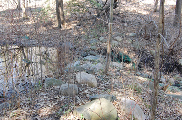
At the north end of the map (top in the map image) one sees the blue of open water which is today's remnant of the original open water aquatic pool from the time of Eloise Butler's dam. It has been called "Mallard Pool" but the original Mallard Pool was located just north of the current back fence of the Garden. (see this article for details). Eloise replaced her earthen dam with a concrete one in 1917 and Martha Crone had the concrete dam repaired after 1955 when it had crumbled. The current rock outcropping dam was constructed in 1992. when the back boundary of the Garden was re-aligned northward to its current position. The boundary used to be right at the dam. Water passing over the dam, now trickles down a gentle slope and exits the Garden beneath the back fence and passes under the tarvia path.
Historical notes

The area to the north of the current Garden boundary was once part of the Garden tended by Eloise Butler. The area contained a large cattail wetland that accepted drainage from the wetland in the Garden and also drainage from a natural spring that lies just outside the Garden's current back gate. It was in this area that she had constructed what she called "Mallard Pool." The area was partially enclosed with a fence and wetland plants were frequently planted there by her until her death in 1933. No further activity happened in that area after 1939 and by 1944 it was separated from the Garden and is now a wild area. More details in this article.
Views of the trail through the wetland.

In 1907 when the Garden was formed, it was a true bog at the southern end with some open water and a large number of Tamarack Trees. Over the years, the decrease in water flow, the decrease in the number of Tamarack and the encroachment of shade tolerant shrubs has resulted in the transformation of the area into a shrubby wetland.

A corduory trail through the center of the wetland was added in 1946 by Garden Curator Martha Crone, in order to give visitors a better view of the area. At the time there was still the small open pool created by Eloise Butler in the area shown on the color map above. But but climate was very dry in the 1930s and the water level fluctuated greatly. Martha Crone wanted visitors to have a close-up view of aquatic plants just as Eloise did but the changes in water level and the shadiness of the small pool made that difficult. So, in 1939 Martha had a spring tapped on the west shore of that open pool and it supplied a good flow of water. (Details in 1939 history). Another stream bed was dug at the same time to assure water movement during exceptionally rainy years. A stream bed exists today and occasionally has to be dug out due to silting.
Saratoga Springs was the original name of area where Wirth Park is today and, as the name suggests, there was a time when the area’s water table was much higher and springs and seeps were everywhere.
Friends' member J. S. Futcher remembers that when he was a kid in the 1940s there were three main springs in the area of Garden - the Great Medicine Spring, considered the main one; another on the northwest corner of Glenwood and Theodore Wirth Parkway; and one to the east of the current back gate of the Garden. Wirth Lake is fed by springs and he remembers swimming there and feeling the cold spring water coming up from the sandy lake bottom in certain spots. He further states his belief the the 1962 addition to the Wirth Park Par 3 Golf Course had some effect on the drying up of the springs as the course was built on top of what was a marsh. (Read more of Futcher). Also, this article has more detail on all the springs.

Gardener Ken Avery kept track of many of the springs in the Garden area and their rise and fall with changes in ground water level. By the late 1950s many began to dry up but sometimes springs he counted as dead, might return to life a year later but he remembered that 1959 was the last year than any spring ran continuously. Still, the area continues to become drier, and the wetland gradually loses its acidity because of natural processes and the use of supplemental city water that occurred in prior years. Much of the original plant community remains. City water has not been used since 2006.
City Water: A city water supply was added to the Upland Garden in 1947, at the close of the season, to supplement rainfall in that drier area of the Garden. The connection to the city water supply was made Northeast of the Garden at Xerxes Ave. and Chestnut Street. (Martha Crone's log - 1947) The crew ran out of narrow diameter pipe and the final leg was built with larger diameter pipe, resulting in poor water pressure. (The Fringed Gentian™, Vol. 26 No.1. Winter 1978, Interview with Martha Crone.) It would be years before the supply was extended to the lower garden area. In 1961 Ken Avery specifically requested that the water lines be run to the Woodland Garden to avoid having to lug hoses around and run them from the water source in the Upland Garden. in 1964 Ken's suggestion of running flexible black pipes was approved and the lines were run.

As a result of the dryness that could seriously affect the wetland area in certain years, Martha Crone had three pools dug out in 1946/1947. [see map below for location]. There were now four in total within what is the current garden wetland space, including the one that was the original small pool of Eloise Butler's time. In 1948 Martha had the new pools enlarged. These pools in the wetland subsequently silted in and had to excavated several times. Gardener Ken Avery and assistant Ed Bruckelmyer did the first excavation in 1961, removing swamp grass and digging out to a depth of 18 inches. The pools were not connected and if rainfall was not sufficient, the pools would be filled with a hose run from the city water supply in the Upland Garden, one pool at a time. So when Ken and Ed dug out the pools they created a channel from one to the other so that filling one would cause the others to fill also. By 1965 the pools were only 6 inches deep so Ken dug them out again, this time to a depth of two feet. But by then he had installed the water supply into the lower garden so if a hose was needed, it was closer. By 1979 the pool channel was silted in and had to be dug out once more.
Eventually, the three pools were left silted in and today, while there can be standing water in the wetland, there is not a series of open pools, but only the remnant of the open pool that existed from Eloise Butler's time. That north-end pool was dredged in 1991/92 but has subsequently silted in again. The small steam in the wetland still flows when rainfall is adequate and seepage from the area usually allows a constant trickle of water to go over the dam and flow into the north meadow where the Mallard Pool used to be. A hazard of the drier periods of today is that it is easy to start a peat fire in the wetland. This has happened several times when Garden cleanup debris is burned.
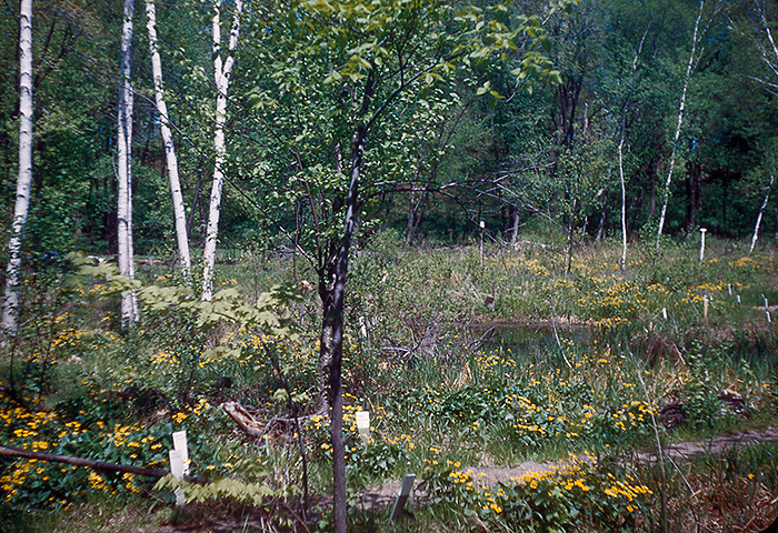
Below: A view of the wetland on May 27, 1950 showing some of open water from one of Martha Crone's pools. Photo from a Kodachrome taken by Martha Crone.
Below: Map of the trails in the Garden as used in the 1952 self-guided brochure. The "swamp trail" was created in 1946. It is believed that the short side paths off of that and possibly part of the "violet path" were the 1946/1947 additions as all the trails show up on a 1947 aerial photo. The position of the 3 new pools is noted. Map is not to scale - the vertical distance is much compressed to fit the brochure. Map courtesy J. S. Futcher Collection.

Below: This aerial photo from 1947 shows Martha Crone's new path in the wetland and the 3 small aquatic pools. The white blobs are photo defects. Photo courtesy University of Minnesota.

A detailed review of the water in the Garden is found in this article.
The wetland plant community
Wetland plants are generally classified in three categories: Submerged (e.g. milfoils, pond weeds, wild celery), floating (e.g. water lilies, duckweed) and emergent (cattails, bulrushes, purple loosestrife).
Another broader group of plants prefers moist conditions, though not necessarily acidic or bog habitats. This group included Jewelweed, Forget-me-nots, Turtlehead, queen-of-the-meadow and cow parsnip to name just a few (more are detailed below).

Here is some detail on three plants of the wetland: Jewelweed (Impatiens capensis and I. pallida. Broadleaf Arrowhead (Sagittaria latifolia) and Pink Turtlehead (Chelone lyoni).
Jewelweed, both Pale Jewelweed (Pale touch-me-not) and the Spotted Jewelweed, are two of the relatively few wildflowers that are true annuals. Because of this their abundance varies from year to year - and they are found only in moist areas of the Garden during drier years. "Touch-me-not" is the common name given to Jewelweed because when ripe, the seed pods explode with just the gentlest “touch”. Also the crushed leaves make an excellent poultice for soothing poison ivy rashes. Jewelweed can be quite aggressive and cover large areas, preventing the growth of less aggressive plants. The photo above shows a good swath of Spotted Jewelweed in the bog on August 27, 2009.

This is a good spot to insert a story about the aggressiveness of Jewelweed. In 1976, Clinton Odell’s daughter Moana Odell Beim (who was president of The Friends of the Wildflower Garden at the time) wrote in the Friends Newsletter, The Fringed Gentian™ [Vol. 24, No.1] about an argument her father had with Eloise Butler about planting Jewelweed. At the time Odell (the future founder of The Friends of the Wild Flower Garden) was a student of Butler’s and a frequent Garden visitor and helper. Eloise believed everything wild had a place in the Garden. She believed that what were called “weeds” should not be so called. The argument was whether Jewelweed should be maintained and planted when necessary. She won.

Odell reported in his journal “The first year Jewelweed marched through the bog . . . the second year it started up the hill. The third year it went up and over the hill and something is darn well going to be done!” Workers were brought in and they pulled Jewelweed for days. Moana Odell Beim remembered many hours spent with her dad in later years pulling Jewelweed, particularly in 1945 when Curator Martha Crone reported another major effort to reduce the quantity of the plant. Martha had written a year earlier "The later flowers [of the season] found difficult competition in the abundant growth of Jewelweed and nettle. The seedlings of the Jewelweed appearing in such great numbers as to take complete possession of the garden. The program of their removal will greatly aid the establishment of desirable plants."(4)

Red Turtlehead flowers in late summer. Located at the intersection of the wetland trails adjacent to the boardwalk, it draws a lot of attention from both visitors and bees. The pink Turtlehead (Chelone lyoni) is often identified incorrectly as the native Red Turtlehead (Chelone obliqua). The Turtlehead in the wetland is thought to be a cross between the pink Turtlehead - a garden escapee that is native to southern states and the native Red Turtlehead. It has been kept both for the pure pleasure of its floriferousness and the desirability of keeping one of Eloise Butler’s naturalized plantings. These plants came from policeman Mr. Rohl's garden in Minneapolis, 1931, to replace a stolen clump that had previously came from him also. Martha Crone planted it in 1946, '47, '48 and '57, and has presumably been in the Garden continuously. The Red Turtlehead (Chelone obliqua) is considered native to Minnesota but distribution in the state is not well documented. It (Red Turtlehead) is on the threatened or endangered list is several states, Michigan, being the closest to us in Minnesota.
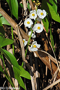
Broadleaf Arrowhead or "Duck Potato" is a true aquatic plant growing best in 6 to 12 inches of water, and it would be a mistake to try to grow it in a a home garden. The Garden species (Sagittaria latifolia) is one of 15 arrowheads found in the region. It is a striking plant with a raceme sporting three-petal white flowers that emerge in late summer. Tending to colonize when conditions are right, its effect - standing erect - above the water, is quite dramatic. Plants can be 2 to 3 feet tall. As the common name infers, the seeds and tubers provide food for waterfowl, wading birds, muskrats and beaver. While it is growing the plant extracts large amounts of nutrients and metals from the water, while reducing turbidity.
The plant has a range from New Brunswick to British Columbia and south throughout the United States to Mexico with only Nevada reporting no population. In Minnesota it is reported in all counties in the eastern part of the state and the majority of counties in the western part.
Other plants of the Wetland Area
The section below lists a number of plants that grow in the wetland area of the Eloise Butler Wildflower Garden.
These are all located close to the pathways so the visitor may easily get a look at them. Flowering time is given. Go to additional information and photos by clicking the link on the plant name.

Polygonum sagittatum.
Tearthumbs are weak-stemmed plants that sprawl in moist areas. The stems are covered with recurved spines that can tear flesh. Leaves are arrow shaped and whitish-pink flowers are borne in terminal clusters. Late summer to autumn .

Bidens cernua.
A low plant (up to 3' but usually much less) of wet places with lance shaped stalkless leaves in pairs. The yellow flower head is 1/2 to 1 1/2" wide and nods when the fruit forms. The seeds (achenes) stick to clothing and animal fur. Late Summer.
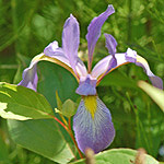
Iris versicolor.
1 to 3 feet high with 3-petal flowers about 4 inches wide that are blue with yellow veins. Very showy. Leaves are sword-like typical of Iris. Early Summer.
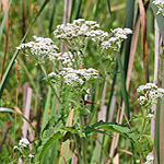
Eupatorium perfoliatum.
Up to 5 feet high, the stem with long hairs, with 7 to 11 small white flowers in each of the many small clusters that make up the broad branching clusters at the top of the stem. Leaves are opposite, toothed, and with a wide base distinctively pierced by the stem. Late Summer.

Cephalanthus occidentalis.
This unique wetland shrub, named for the round flower heads, begins bloom in early summer. The small white tubular flowers that grow out of the round 1" wide head have a long protruding style.

Lobelia cardinalis.
The brilliant scarlet Cardinal Flower has the flowers on a tall spike above lance shaped alternate leaves that are toothed. 2 to 5 feet in height. Late Summer.

Typha latifolia
Narrowleaf Cattail
Typha angustifolia
There are two different cattails. The leaves and flowers vary in appearance. Early summer to fall.

Heracleum maximum.
Broad cluster of very small white flowers in large fairly flat-topped umbels that are atop a hairy stem of up to eight feet high. Early Summer.
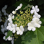
Viburnum opulus var. americanum.
A large shrub, common at the north end of the bog. Showy white blooms in late spring and brilliant red berries in Autumn.

Doellingeria umbellata.
Small flower heads (1/2 to 3/4") with 7 to 14 white rays growing atop tall stems, 3 to 6 feet high, in a flat-topped cluster. Late summer to autumn.

Myosotis scorpioides.
The downy stems are weak and sprawling, small blue flowers up to 3/8 inch wide, that have a yellow eye; the flowers grow on short racemes. Early to late summer.

Eupatoriadelphus maculatus.
Stems are purplish and speckled, about 5 feet high. Leaves in a whorl. Flowers in grouped terminal clusters at top of stem, 12 to 20 flowers per cluster. Late summer.
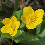
Caltha palustris
Found throughout the wetland. One of the first splashes of green to show in the wetland, followed by the brilliant yellow flowers. Flowers persist while the wetland greens-up. Early May.
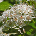
Physocarpus opulifolius
A shrub with showy white flowers in clusters. The branches are long, re-curved, and the old bark on branches will peel in layers or strips. The fruit is a small seed capsule. Early summer flowering.

Alisma triviale
An erect flowering stem, 1 to 3 feet, of many whorled branches containing 1/3 inch wide white petaled flowers. Large leaves form a base rosette. Usually has its feet in water. June to late July.
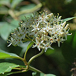
Cornus obliqua.
Tall shrub. The leaves are pale beneath and tapered at both ends; fruits in Autumn are deep bluish; flowers are white, 4-part, appearing in a flat branched cluster in late May to through June. Stems are purplish. Grows near the Ninebark, just off the boardwalk.
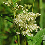
Filipendula ulmaria.
Growing in prolific numbers near the boardwalk bridge, The small white 5 part stalked flowers appear in dense clusters near the tops of the stems of up to 6 feet. Leaves are pinnately divided and doubly toothed; the underside the leaves are gray-white, hairy and prominently veined. Early Summer.

Filipendula rubra.
A beautiful pink version of the Queen of the Meadow and is similar in description except seeds and leaves are slightly different. It grows along the path west of the bridge.
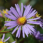
Symphyotrichum puniceum.
Tall aster with blue-violet to purple rayed flowers, 1 to 1 1/2" wide, with 30 to 60 rays, the stems stout, hairy and reddish. The larger leaves have shallow teeth and taper to a base that clasps the stem. A white version is also present. Autumn.
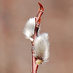
Salix discolor.
A small tree of wetlands and swamps. It can grow from 10 to 20 feet. The catkins of early spring are showy and in Minnesota at least, considered a harbinger of spring temperatures.

Cornus sericea ssp. sericea
Common dogwood of the woodland. The "red" refers to the color of the younger branches in fall, winter and spring. Flowers are white and fruit is white to lead color. Grows to be a large shrub, up to 9 feet high and tends to form thickets. Flowers end of May through the summer.
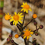
Packera aurea.
Basal leaves that are bluntly rounded, heart shaped at the base and longer than wide. The flower heads are a deep golden color with shiny yellow petals. The flower stem can be from 6 to 30" high. Late May.
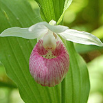
Cypripedium reginae.
State flower of Minnesota. The sepals and lateral petals are white while the lip or pouch is white, with pinkish tinges and streaked with rose or purple. Stems are usually about two feet high, the slippers about 2" long. Usually blooms first 2 weeks of June.

Symplocarpus foetidus.
The earliest sign of spring. The flowers on this plant are on a spadix (knob shaped cluster) contained within a spathe, which on this plant is mostly purple-brown and mottled with green, hidden once the large green leaves appear. March to early April.

Asclepias incarnata.
The most attractive species of milkweed with striking flowers (in umbels at the top) that vary from pink to rosy-purple. Blooms early to late summer.

Larix laricina.
A conifer with the distinction of being deciduous. The new needle growth begins in early spring, forming as clusters of more than five on short shoots. The needles turn gold in the Autumn.

Chelone glabra.
The white flowers (can have a pink tinge on top) have two almost closed lips. The lower lip has three lobes with the center one bearded. Flowers are on a short spike at the end of the stem and above the long lance shaped, toothed and hairless leaves. Late summer.

Equisetum fluviatile.
The stem is green, 80% hollow, jointed, with 15 to 20 dark brown tooth-like points on a membrane at each joint from which the cylindrical leaves emerge. Some stems may branch near the top, Fertile stems end in a small spore producing cone. Early summer.
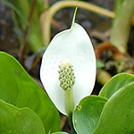
Calla palustris.
The basal leaves are large and heart shaped with a 2 to 6 inch stalk. The inflorescence having a white spathe beside a knob shaped 1 to 2 inch spadix covered with tiny yellow-greenish flowers that have six stamens. Late spring.
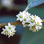
Ilex verticillata.
A large shrub growing in the wetland, forming red 1/4 inch berries in the fall, The small greenish-white flowers form in the leaf axils in early summer. The leaves are sharply and double toothed. Fruit is poisonous to humans.

Pale Yellow Iris
Iris pseudacorus.
1 to 3 feet high with yellow flowers about 4 inches wide and as it spreads via rhizomes, it forms clumps. It is not native and is considered invasive in Minnesota. Flowers last half of June.
Here is a second group of the wetland plants with photos only - use the link for more information.

Ribes americanum

Lycopus americanus

Lycopus uniflorus
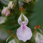
Teucrium canadense

Ranunculus recurvatus
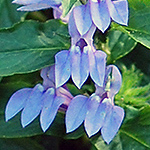
Lobelia siphilitica

Bidens frondosa

Bidens connata

Ranunculus abortivus

Lysimachia nummularia
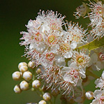
Spiraea alba

Mimulus ringens
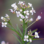
Cardamine pensylvanica

Maianthemum stellatum

Lysimachia terrestris
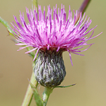
Cirsium muticum

Trillium sessile
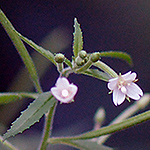
Epilobium coloratum

Mentha arvensis